


Sort by:


Spain – Historical Map – Vintage Illustrated Spanish Cartography
From $27.00
This beautifully illustrated historical map of Spain showcases the country’s rich cultural heritage, iconic landmarks, and historical geography. Featuring detailed drawings of castles, cities, and regions, this vintage map brings...


Spain 1900 General Map Poster – Bold Iberian Peninsula Print for Cultural Discovery
From $34.00
Embark on a journey across Spain with this 1900 General Map, reflecting a nation consolidated after centuries of regional diversity and imperial ventures. Each province captures distinct languages, traditions, and...


Spain & Portugal Map 1872 Provinces Family Atlas Print - Madrid, Lisbon, Barcelona, Seville, Porto
From $34.00
The Society for the Diffusion of Useful Knowledge, a British body founded to spread inexpensive education, is credited with this Spain and Portugal in Provinces, which Edward Stanford of London...


Spain and Portugal – Antique Map – Historic Cartographic Print with Ornate Illustrations
From $27.00
This breathtaking antique map of Spain and Portugal is a remarkable cartographic piece, beautifully restored to showcase the Iberian Peninsula’s historical geography. Featuring detailed political divisions, major cities such as...


Spain & Portugal Map 1831 Georgian Atlas Print - Madrid, Lisbon, Valencia, Bilbao, Faro
From $34.00
Spain & Portugal was drawn and engraved by J. Dower and published by Henry Teesdale & Co. in London in 1831, one of the maps in the first edition of...


Spain & Portugal Map 1836 Environs of Madrid Inset Print - Madrid, Lisbon, Barcelona, Seville, Valencia
From $34.00
Henry S. Tanner of Philadelphia published this Spain and Portugal, with an inset titled Environs of Madrid, in his New Universal Atlas, and the catalog dates the map to 1836...


Spain, Portugal & Andorra Map 1922 Italian Atlas Print - Madrid, Lisbon, Andorra la Vella, Barcelona, Gibraltar
From $34.00
Mario Baratta and Luigi Visintin made this Regione Iberica (Spagna e Portogallo) for the Grande atlante geografico of the Istituto Geografico De Agostini of Novara, the first great Italian atlas,...


Spain & Portugal Map 1893 World's Fair Atlas Print - Madrid, Lisbon, Barcelona, Seville, Porto
From $34.00
George Cram of Chicago published this Spain and Portugal in The Columbian World's Fair Atlas, an uncommon atlas of ninety maps issued in 1893 to commemorate the World's Columbian Exposition...


Spain & Portugal Map 1897 Large-Format Atlas Print - Madrid, Lisbon, Barcelona, Seville, Valencia
From $34.00
Rand McNally and Company of Chicago published this Spain, Portugal in its Indexed Atlas of the World in 1897, in the foreign countries volume of a two-volume set. The sheet...


Spain & Portugal Map 1882 Railways & Telegraph Cables Atlas Print - Madrid, Lisbon, Barcelona, Seville, Porto
From $34.00
Edward Stanford of London published this Spain and Portugal in 1882 in Stanford's London Atlas of Universal Geography, the quarto edition of forty-four colored maps. The steel-engraved sheet measures 33...


Spain & Portugal Map 1831 Atlas Print - Madrid, Lisbon, Barcelona, Seville, Porto
From $34.00
John Dower drew and engraved this Spain & Portugal for Henry Teesdale & Co. of London, and it was issued in 1831 in the first edition of A New General...


Spain & Portugal Map 1863 French Atlas Print - Madrid, Lisbon, Barcelona, Seville, Valencia
From $34.00
Eugène Andriveau-Goujon of Paris published this Espagne et Portugal, number 28, in the 1863 new edition of his Atlas classique et universel de géographie ancienne et moderne, an atlas of...


Spain & Portugal Map 1831 American Atlas Print - Madrid, Lisbon, Barcelona, Seville, Cádiz
From $34.00
Anthony Finley of Philadelphia published this Spain & Portugal in 1831 in A New General Atlas Comprising a Complete Set of Maps, representing the Grand Divisions of the Globe, an...


Spain & Portugal Map 1851 Illustrated Vignette Atlas Print - Madrid, Lisbon, Barcelona, Seville, Valencia
From $34.00
John Tallis of London published this Spain and Portugal in 1851, a full-color map engraved for R. Montgomery Martin's Illustrated Atlas. The Rare Maps catalog calls it a striking example...


Spain & Portugal Map 1964 Pergamon World Atlas Print - Madrid, Lisbon, Barcelona, Seville, Porto
From $34.00
The Polish Army Topography Service compiled this Spain and Portugal for the Pergamon World Atlas, which Pergamon Press of Oxford issued together with Polish Scientific Publishers of Warsaw. The map...


Spain & Portugal Map 1890 Railroads Atlas Print - Madrid, Lisbon, Barcelona, Seville, Porto
From $34.00
Samuel Augustus Mitchell's New General Atlas, published in Philadelphia by John Y. Huber and Company in 1890, is the source of this Spain & Portugal, which carries a Bradley copyright...


Spain & Portugal Map 1846 Lithographed Atlas Print - Madrid, Lisbon, Barcelona, Seville, Valencia
From $34.00
Samuel Augustus Mitchell of Philadelphia published this Spain and Portugal, with Environs of Madrid, in the 1846 edition of A New Universal Atlas, the first issue by Mitchell alone. The...


Spain & Portugal Map 1856 Gibraltar Inset Print - Madrid, Lisbon, Barcelona, Gibraltar, Palma
From $34.00
George W. Colton drew this Spain and Portugal for Colton's Atlas of the World, published by J.H. Colton and Company in New York in 1856. The catalog calls the one-volume...


Spain & Portugal Map 1956 Mid-Century Times Atlas Print - Madrid, Lisbon, Barcelona, Palma, Porto
From $34.00
John Bartholomew and Son of London produced this Spain and Portugal for The Times Atlas of the World, Mid-Century Edition, published with Houghton Mifflin of Boston, and the catalog dates...


Spain & Portugal Map 1860 Family Atlas Gibraltar Inset Print - Madrid, Lisbon, Barcelona, Gibraltar, Málaga
From $34.00
A.J. Johnson drew this Spain and Portugal for Johnson's New Illustrated Family Atlas, published by Johnson and Browning of New York in 1860, the successors to J.H. Colton and Company....


France, Spain & Portugal Map 1860 Atlas Print - Paris, Madrid, Lisbon, Marseille
From $34.00
Samuel Augustus Mitchell Jr. of Philadelphia published this Map of France, Spain, and Portugal in 1860 in Mitchell's New General Atlas, the first edition of the atlas that replaced his...


Valencia 1905 City Map Poster – Classic Spanish Layout Print for Urban Culture Lovers
From $27.00
Discover the timeless charm of Valencia through this 1905 city map, tracing cobblestone streets and lively plazas that reflect centuries of Moorish influence, maritime trade, and progressive urban design. Observe...


Mallorca 1814 Old Map Poster – Authentic Spanish Island Print for Historical Travel Fans
From $27.00
Witness Mallorca’s rich past with this 1814 map, revealing a Mediterranean island shaped by centuries of cultural exchange, maritime routes, and agrarian traditions. Coastal outlines trace ports once bustling with...


Cuba, Hispaniola & Puerto Rico Map 1744 Regional Print - Havana, Cap-Francais, Ponce
From $34.00
Emanuel Bowen engraved this two-map sheet of Cuba, Hispaniola and Puerto Rico in London in 1744, working at the height of a career distinguished enough to earn him appointments as...


Barcelona Grid City Map Print - 1910 Spanish Urban Expansion - Vintage Catalonia Cartographic Treasure
From $27.00
This beautifully preserved 1910 map of Barcelona captures the city in a pivotal moment of its transformation into a modern European capital. The layout reveals the famous Eixample district with...


Cuba, Hispaniola & Puerto Rico Map 1744 Regional Print - Havana, Santo Domingo, San Juan
From $34.00
This pair of highly detailed engraved maps of Cuba, Hispaniola and Puerto Rico was published together on a single sheet in London in 1744 by Emanuel Bowen, one of the...


Mallorca 1814 Map Poster – Spanish Island Heritage Print for Mediterranean Culture Fans
From $27.00
Step into early 19th-century Balearic life with this 1814 Mallorca Map, unveiling a sunlit island in the throes of trade, agriculture, and a centuries-old seafaring tradition. Sweeping coastlines wrap around...


Pyrenees Map 1882 Military Atlas Print - Toulouse, Pau, Bayonne, Perpignan, Pamplona
From $34.00
Furne, Jouvet et Cie of Paris published this Carte Militaire des Pyrénées in 1882 in the Atlas Universel de Géographie Moderne, the atlas known as the Atlas St. Cyr because...


Mallorca, Menorca & Ibiza Map 1823 Atlas Print - Palma, Mahón, Ibiza Town
From $34.00
Franz Ludwig Güssefeld's Atlas von Spanien, published in 1823 and based largely on the drawings of Tomás López, is the source of this Carte des Isles de Maiorque, Minorque et...


Bruges Map 1740 Rapin Fortifications Plan Print - Bruges, Flanders, Fortifications, Spanish Succession
From $34.00
This detailed plan of Bruges, titled Bruges one of the Principal Cities of Flanders, was published in London in 1740 and is the work of Paul de Rapin de Thoyras....


Hispaniola, Puerto Rico & Virgin Isles Map 1817 Print - San Juan, Santo Domingo, St. Croix
From $34.00
This twin-map sheet of Puerto Rico, the Virgin Islands and Hispaniola was published in Edinburgh in 1817 by John Thomson, a commercial map publisher who specialized in guidebooks and atlases...


Barcelona 1910 Map Poster – Catalonia’s Modernista Gem Print for Urban Culture Enthusiasts
From $27.00
Enter the Catalan capital during a period of transformative urban planning with this 1910 Barcelona Map, recording a city where modernista architecture, medieval quarters, and bustling ports converged. A grid-like...


Honduras 1929 Map Poster – Central American Landscape Print for Explorers and Heritage Seekers
From $27.00
Journey into a Honduras of the early 20th century with this 1929 Map, highlighting mountainous interiors, tropical coastlines, and towns steeped in pre-Columbian and colonial stories. Tracing the boundaries, you’ll...


Puerto Rico Map 1842 Survey Print - San Juan, Ponce, Mayaguez
From $34.00
This chart of Puerto Rico was published in 1842 by the Direccion Hidrografica de Madrid, the Spanish government's official hydrographic office, which traced its institutional roots back to the Casa...


West Indies & Panama Canal Map 1967 Regional Print - Port-au-Prince, Kingston, Panama City
From $34.00
This map of the West Indies was issued in Moscow in 1967 by the Chief Administration of Geodesy and Cartography under the Council of Ministers of the USSR, as page...


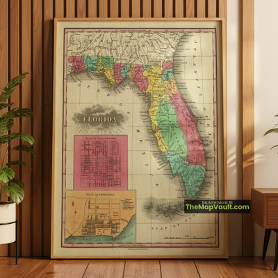
Florida Map 1831 Territorial Print - Tallahassee, Pensacola, St. Augustine, Apalachicola
From $34.00
Anthony Finley published this map of Florida in 1831 for his New General Atlas, engraved by J. H. Young and issued from Philadelphia with dedicated inset plans of Tallahassee and...


Panama 1865 Map Poster – Isthmian Gateway Print for Global Transit Admirers
From $34.00
Transport yourself to a pivotal crossroads of hemispheres with this 1865 Panama Map, depicting the narrow land corridor that joined vast oceans and orchestrated epic trade routes. Each labeled settlement...


Mexico & Southwest US Map 1795 Regional Print - Santa Fe, Tucson, Baja California
From $34.00
Thomas Kitchin, trained in Emanuel Bowen's London workshop before becoming one of the most prolific engravers of his own generation, produced this map of Mexico and New Spain to illustrate...


Mexico & Southwest US Map 1795 Regional Print - Chihuahua, Sonora, New Mexico
From $34.00
This engraving of Mexico and New Spain came from the hand of Thomas Kitchin, an engraver who learned his trade under Emanuel Bowen before building an independent reputation prolific enough...


Alsace Lorraine 1890 Print – A Stunning Vintage Map for Celebrating French Regional Heritage and Cultural Legacy
From $27.00
Immerse yourself in the storied landscapes of northeastern France with this 1890 map of Alsace Lorraine, a region famed for its blend of French and German influences. Intricate borders, quaint...


Mexico & Central America Map 1740 Regional Print - Mexico City, Guatemala, Florida
From $34.00
Giambattista Albrizzi engraved this map of Mexico and Central America in Venice around 1740 for his Lo Stato Presente di Tutti i Paesi e Popoli del Mondo, an ambitious Italian...


Puerto Rico Island Map 1886 Vintage Print – Explore Colonial-Era Heritage and Scenic Coasts
From $27.00
Immerse yourself in the late 19th-century character of Puerto Rico with this meticulously recreated 1886 map, an authentic snapshot of the island’s diverse terrain and historic municipalities. Wander through once-thriving...


France & Corsica Map 1906 Atlas Print - Paris, Lyon, Marseille, Toulouse, Ajaccio
From $34.00
W. & A.K. Johnston Limited of Edinburgh and London published this France in 1906 in the second edition of The Victoria Regina Atlas, Political, Physical and Astronomical, a world atlas...


Barcelona – Historic Map – Vintage Urban Plan & Architectural Heritage
From $27.00
Explore the iconic city of Barcelona through this beautifully restored historic map, a remarkable representation of the city’s unique grid system, districts, and historic landmarks. This vintage urban plan captures...


United States 1850 Map Poster – Classic American Expansion Print for National History Enthusiasts
From $34.00
Journey into the mid-19th century with this 1850 United States Map, capturing a landscape where vast frontiers, evolving territories, and newly admitted states signaled a nation poised for rapid change....


Venezuela – Vintage Map – Antique Geography Print
From $27.00
This beautifully restored vintage map of Venezuela presents an intricate depiction of the country’s physical and political geography, featuring mountains, rivers, and major cities. Originally crafted in an antique style,...


Finland Postal Map 1799 Von Reilly Postal Atlas Print - Finland, Norrland, Postal Routes, Vienna
From $34.00
This rare postal map of Finland and Norrland was drawn by Franz Johann Joseph von Reilly and appeared in Von Reilly and Kuhn's Atlas Universae rei veredariae bilinguis, also titled...


Mexico Map 1757 Regional Print - Acapulco, Tamaulipas, Mexico City
From $34.00
Antoine Francois Prevost's fifteen-volume Histoire Generale des Voyages, the era's most ambitious compilation of global exploration accounts, called on Jacques-Nicolas Bellin, France's chief naval hydrographer, to supply this map of...


El Salvador and Honduras 1839 Map Poster – Central America Print for Culture Fans
From $27.00
Witness the evolving heart of Central America with this 1839 El Salvador and Honduras map, a vivid testament to two nations forging separate yet intertwined paths. Each boundary marks a...


Hungary 1851 Map Poster – European Heritage Print for Central Europe Admirers
From $27.00
Step into 19th-century Hungary with this 1851 map, capturing a kingdom where diverse influences merged under shifting borders. Expansive plains stretch along the Danube, punctuated by the northern mountains that...
- Choosing a selection results in a full page refresh.